About county maps: BOATs and UCRs
TrailCapture contributors are working on filming and categorizing Public Rights of Way, with information sorted by county/region. This will include BOATs and UCRs and will come from the PRoW maps on county council pages and OS map research, local knowledge and contributor submissions. We won't include every tiny lane and will exclude any tarmac trails, those too near residential sites and those with permanent TRO restrictions.
For links to county council PRoW webpages see the document at the end of the 'Disclaimers' page and in each TrailVidz map.
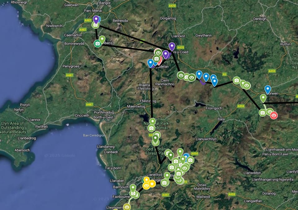
Here is an example snippet from the map for North West Wales.
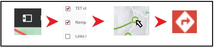
*Open the layers tab to select map elements.
*Green map pins contain text, pictures & video links.
*You can expand the map to fill the screen.
*To navigate, select a marker then hit the navigation button to route to that destination.
Colour coding
Filmed trails and grading
Filmed trails are green and graded Grade 1, 2 or 3.
Darker green = harder trail. Each grade can be modified with + or -
Some routes are harder in the opposite direction. This is reflected by two coloured lines denoting the difficulty in each direction of the trail, with notes and pictures to explain.
Purple or blue trails are unfilmed.
Light olive green routes are unfilmed, but judged as Grade 1 using the satellite map.
Orange trails are byways or unclassified roads which might be worth exploring but may not lead anywhere useful or link up with public roads
For more about becoming a TrailVidz subscriber, click here