Map overview
It's no secret that there are some amazing lanes and byways out there. It's public information. But you never know what you're letting yourself in for. Deep ruts, rocky climbs, muddy water crossings...
TrailVidz is a visual dictionary of the trails. This route reference resource is curated using county council definitive maps, contributor routes, local knowledge and well known established trail routes, with video footage taken by a growing TrailCapture team.
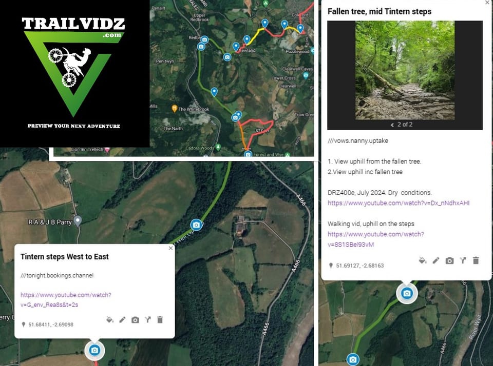
Here is an example extract from the map for North West Wales.

All green routes are off-tarmac trails with at least one visual reference uploaded. Just click the trail's camera icon for info, pics and video links. Eye icons contain still pics. All trail entry/exits have a map pin with a w3w name for easy location and navigation.
Grading
This is based on the footage in the conditions on the day.
The darker the green, the harder the trail. Each grade can be modified with + or -
Light green is Grade 1. Off-tarmac surfaces like gravel or light mud with moderate or no inclines, all of which should be accessible by all riders.
Mid green is Grade 2 and contains terrain which will present a challenge to heavier bikes or the solo traveller without extra help if things get horizontal.
Dark green is a route which contains elements of challenge which will really test a new rider or a heavy bike. Enduro riders will probably be ok.
Yellow is a warning! These routes could present serious problems to the solo rider and will likely need teamwork or an enduro to complete.
Some routes are harder in the opposite direction. This is reflected by two coloured lines denoting the difficulty in each direction of the trail, with notes and pictures to explain.
Purple routes are trails we haven't filmed yet.
Light olive green routes are unfilmed trails, but judged as Grade 1 using the satellite map.
Orange routes are byways or unclassified roads which might be worth exploring but may not lead anywhere useful or link up with public roads.
Between trails there are red or black link lines which simply form a shape and differentiate between loops. There are no prescribed routes between trails.
The maps are best viewed on a desktop monitor. They are intended as reference material for planning and preparation, not for use in the field, however if you tap to fill the screen, you can use it to navigate to the start or end of any given route. So if you have to turn around or want to skip a trail, it's easy to route to the next one.
To read about TrailVidz membership, click here